
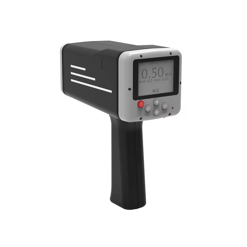
Handheld radar flow meters, known for their non-contact operation, high precision, and rapid deployment, are transforming traditional hydrometric methods globally. In Indonesia—an archipelago with complex river systems, challenging terrain, and frequent extreme weather—their value is particularly significant.
Here are the typical application cases and an analysis of their advantages in the Indonesian context.
Core Advantages: Why are Handheld Radar Flow Meters Ideal for Indonesia?
- Safety and Efficiency: Measurements are taken without contacting the water, allowing operators to work safely from bridges, riverbanks, or steep slopes. This is perfect for Indonesia’s rivers, which can become swift, turbulent, and dangerously unpredictable during heavy rains.
- Adaptability to Complex Terrain: Many Indonesian rivers are in remote or jungle-covered a
- reas where traditional cableways or boat measurements are impractical. The portability of handheld radar units allows survey teams to carry them to any location with a line of sight to the water.
- Rapid Response: For flood emergency monitoring, a single-point surface velocity measurement can be completed in minutes, providing critical data for early warning systems and decision-making.
- Low Maintenance: Largely unaffected by sediment or debris in the water, these devices experience less wear and tear in Indonesia’s often sediment-rich rivers, reducing maintenance costs.
Typical Application Cases
Case 1: Urban and Rural Flood Warning and Monitoring
- Scenario: A river flowing through a city on Java Island (e.g., Ciliwung River). During the rainy season, upstream downpours can cause water levels to rise rapidly, threatening urban areas.
- Application:
- Mobile Survey Mode: Hydrometry teams drive to bridges across the city during flood events. Using a tripod mounted on the bridge railing, they aim the radar flow meter at the water surface. Within 1-2 minutes, they obtain the surface velocity, which is converted to an average velocity and, combined with a stage measurement, provides a real-time discharge value.
- Role: This data is transmitted immediately to flood warning centers to validate and update flood models, providing crucial information for issuing evacuation orders and managing reservoir releases. This method is far safer and faster than deploying personnel to use current meters from the dangerous riverbanks.
Case 2: Water Resource Assessment in Remote Islands and Regions
- Scenario: Water resource planning for undeveloped watersheds on islands like Sumatra, Kalimantan, or Papua. These areas lack permanent gauging stations and are often logistically challenging to access.
- Application:
- Reconnaissance Mode: Water resource survey teams carry handheld radar flow meters into these regions. They conduct rapid flow assessments at representative cross-sections of rivers targeted for small dams, irrigation schemes, or future drinking water sources.
- Role: Provides valuable baseline hydrological data for infrastructure planning and feasibility studies, significantly reducing the difficulty, time, and cost of preliminary surveys.
Case 3: Irrigation Water Management and Infrastructure Evaluation
- Scenario: Complex irrigation canal networks (e.g., the Subak system in Bali) in agricultural regions.
- Application:
- Management Monitoring: Water managers use handheld radar meters to regularly measure flow velocity and discharge at key points like main canals and diversion gates.
- Role:
- Equitable Water Distribution: Accurately measures flow rates to different farming communities, ensuring fair water allocation and reducing conflicts.
- Performance Assessment: Checks if canals are operating efficiently or if their capacity is reduced by sedimentation or weed growth, guiding maintenance decisions.
- Infrastructure Calibration: Evaluates the actual flow capacity of hydraulic structures like sluice gates and weirs against their design specifications.
Case 4: Emergency Monitoring of Flash Floods
- Scenario: Small mountainous watersheds where intense rainfall can quickly generate destructive flash floods.
- Application:
- Emergency Mode: Upon receiving heavy rain forecasts, monitoring personnel can deploy to key road bridges at the outlets of critical watersheds. They can safely measure the surface velocity of the torrential flood from the bridge—a task nearly impossible for traditional contact methods.
- Role: Capturing peak discharge data for flash floods is vital for improving local warning models, delineating hazard zones, and designing protective structures.
Challenges and Considerations
Despite their advantages, applications in Indonesia require attention to:
- Dense Vegetation: Lush rainforest can sometimes obstruct the necessary line-of-sight between the device and the water surface.
- Operator Training: Local staff must be properly trained to understand the principles, such as the fact that surface velocity is measured and how to apply the correct coefficient to convert it to average velocity based on flow and channel conditions.
- Power Supply: Ensuring reliable backup power is available for extended field work in remote areas.
Conclusion
The use of handheld radar flow meters in Indonesia is a prime example of modern hydrometry solving traditional challenges. Their unique non-contact, mobile, and efficient characteristics make them perfectly suited to Indonesia’s complex geography and climate. They play an indispensable role in flood safety, water resource development, agricultural irrigation, and flash flood research, establishing themselves as a key tool for enhancing Indonesia’s hydrometric capacity and modernizing its water resource management.
Complete set of servers and software wireless module, supports RS485 GPRS /4g/WIFI/LORA/LORAWAN
For more radar sensor information,
please contact Honde Technology Co., LTD.
Email: info@hondetech.com
Company website: www.hondetechco.com
Tel: +86-15210548582
Post time: Nov-03-2025