
As the world’s largest archipelagic nation, located in the tropics with abundant rainfall and frequent extreme weather events, Indonesia faces floods as its most common and destructive natural disaster. To address this challenge, the Indonesian government has vigorously promoted the construction of a modern Flood Early Warning System (FEWS) based on the Internet of Things (IoT) and advanced sensing technology in recent years. Among these technologies, radar flow meters, rain gauges, and displacement sensors serve as the core data acquisition devices, playing a crucial role.
The following is a comprehensive application case demonstrating how these technologies work together in practice.
I. Project Background: Jakarta and the Ciliwung River Basin
- Location: Indonesia’s capital, Jakarta, and the Ciliwung River basin that flows through the city.
- Challenge: Jakarta is low-lying and extremely densely populated. The Ciliwung River is prone to overflowing during the rainy season, causing severe urban flooding and river floods, posing a significant threat to life and property. Traditional warning methods reliant on manual observation could no longer meet the need for rapid and accurate early warnings.
II. Detailed Case Study of Technology Application
The FEWS in this region is an automated system integrating data collection, transmission, analysis, and dissemination. These three types of sensors form the system’s “sensory nerves.”
1. Rain Gauge – The “Starting Point” of Early Warning
- Technology & Function: Tipping bucket rain gauges are installed at key points in the upper watershed of the Ciliwung River (e.g., the Bogor area). They measure rainfall intensity and accumulation by counting the number of times a small bucket tips over after filling with rainwater. This data is the initial and most critical input for flood forecasting.
- Application Scenario: Monitoring real-time rainfall in the upstream areas. Heavy rainfall is the most direct cause of rising river levels. Data is transmitted in real-time to a central data processing center via wireless networks (e.g., GSM/GPRS or LoRaWAN).
- Role: Provides rainfall-based warnings. If the rainfall intensity at a point exceeds a pre-set threshold within a short period, the system automatically issues an initial alert, indicating the potential for flooding downstream and buying valuable time for subsequent response.
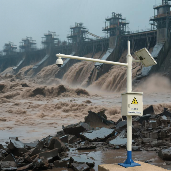
2. Radar Flow Meter – The Core “Watchful Eye”
- Technology & Function: Non-contact radar flow meters (often including radar water level sensors and radar surface velocity sensors) are installed on bridges or banks along the Ciliwung River and its main tributaries. They measure water level height (H) and river surface velocity (V) precisely by emitting microwaves towards the water surface and receiving the reflected signals.
- Application Scenario: They replace traditional contact sensors (like ultrasonic or pressure sensors), which are prone to clogging and require more maintenance. Radar technology is immune to debris, sediment content, and corrosion, making it highly suitable for Indonesian river conditions.
- Role:
- Water Level Monitoring: Monitors river levels in real-time; triggers alerts at different levels immediately once the water level exceeds warning thresholds.
- Flow Calculation: Combined with pre-programmed river cross-section data, the system automatically calculates the river’s real-time discharge (Q = A * V, where A is the cross-sectional area). Discharge is a more scientific hydrological indicator than water level alone, providing a more accurate picture of a flood’s scale and power.
3. Displacement Sensor – The Infrastructure’s “Health Monitor”
- Technology & Function: Crack meters and tiltmeters are installed on critical flood control infrastructure, such as levees, retaining walls, and bridge supports. These displacement sensors can monitor whether a structure is cracking, settling, or tilting with millimeter-level or higher precision.
- Application Scenario: Land subsidence is a serious issue in parts of Jakarta, posing a long-term threat to the safety of flood control structures like levees. Displacement sensors are deployed in key sections where risks are likely to occur.
- Role: Provides structural safety warnings. During a flood, high water levels exert tremendous pressure on levees. Displacement sensors can detect minute deformations in the structure. If the rate of deformation suddenly accelerates or exceeds a safety threshold, the system issues an alarm, signaling the risk of secondary disasters such as dam failure or landslides. This guides evacuations and emergency repairs, preventing catastrophic outcomes.
III. System Integration and Workflow
These sensors do not work in isolation but operate synergistically through an integrated platform:
- Data Acquisition: Each sensor automatically and continuously collects data.
- Data Transmission: Data is transmitted in real-time to a regional or central data server via wireless communication networks.
- Data Analysis & Decision Making: Hydrological modeling software at the center integrates rainfall, water level, and discharge data to run flood forecast simulations, predicting the time of arrival and scale of the flood peak. Simultaneously, displacement sensor data is analyzed separately to assess infrastructure stability.
- Warning Dissemination: When any single data point or combination of data exceeds pre-set thresholds, the system issues alerts at different levels through various channels such as SMS, mobile apps, social media, and sirens to government agencies, emergency response departments, and the public in riverside communities.
IV. Effectiveness and Challenges
- Effectiveness:
- Increased Lead Time: Warning times have improved from just a few hours in the past to 24-48 hours now, significantly enhancing emergency response capabilities.
- Scientific Decision-Making: Evacuation orders and resource allocation are more precise and effective, based on real-time data and analytical models.
- Reduced Loss of Life and Property: Early warnings directly prevent casualties and reduce property damage.
- Infrastructure Safety Monitoring: Enables intelligent and routine health monitoring of flood control structures.
- Challenges:
- Construction and Maintenance Costs: A sensor network covering a vast area requires significant initial investment and ongoing maintenance costs.
- Communication Coverage: Stable network coverage remains a challenge in remote mountainous areas.
- Public Awareness: Ensuring warning messages reach end-users and prompt them to take correct action requires continuous education and drills.
Conclusion
Indonesia, particularly in high-risk flood areas like Jakarta, is building a more resilient flood early warning system by deploying advanced sensor networks represented by radar flow meters, rain gauges, and displacement sensors. This case study clearly demonstrates how an integrated monitoring model—combining sky (rainfall monitoring), ground (river monitoring), and engineering (infrastructure monitoring)—can shift the paradigm of disaster response from post-event rescue to pre-event warning and proactive prevention, providing valuable practical experience for countries and regions facing similar challenges worldwide.
Complete set of servers and software wireless module, supports RS485 GPRS /4g/WIFI/LORA/LORAWAN
For more sensors information,
please contact Honde Technology Co., LTD.
Email: info@hondetech.com
Company website: www.hondetechco.com
Tel: +86-15210548582
Post time: Sep-22-2025