
1. Introduction: The Need for Modern Hydrometry in Indonesia
Indonesia’s geography—defined by over 17,000 islands and a demanding tropical monsoon climate—presents unique challenges for water resource management. For agencies like the Indonesian Ministry of Public Works and Housing (PUPR), maintaining the integrity of vast river networks, strategic dams, and urban drainage systems is a matter of national safety. Traditional hydrometric tools often struggle with the high humidity, heavy sediment loads, and debris characteristic of Indonesian water bodies.
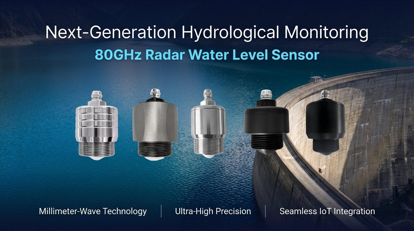
The transition to the 80GHz FMCW Radar Water Level Sensor represents a shift toward a more resilient, data-driven hydrological infrastructure. By utilizing non-contact sensing, this technology bypasses the maintenance pitfalls of submerged sensors, providing the high-precision, real-time data necessary for sophisticated flood early warning systems (EWS) and optimized irrigation control across the archipelago.
2. Core Technology: The 80GHz FMCW Advantage
The effectiveness of this sensor is rooted in its 76-81GHz FMCW (Frequency Modulated Continuous Wave) radar technology. This high-frequency operation provides technical advantages that are critical for the complex environments found in Indonesian infrastructure:
- Millimeter Wave RF Architecture: The integration of a millimeter wave RF chip enables a more compact internal architecture. This results in a higher signal-to-noise ratio and a significantly smaller “blind area,” allowing for accurate measurements even when water levels rise nearly to the sensor’s face—a common occurrence in congested urban drainage and underground pipe networks.
- 5GHz Working Bandwidth: The wide 5GHz bandwidth is the driver behind the sensor’s superior resolution and ±1mm accuracy, ensuring that even the slightest fluctuations in reservoir levels are captured for precise volume modeling.
- Narrow 6° Beam Angle: Unlike lower-frequency sensors with wider beams, this device features a narrow 6° antenna beam angle. In the context of Indonesia’s aging infrastructure—such as narrow Dutch-era bridges or cramped kampung drainage canals—this narrow focus is vital. It prevents “multipath interference” caused by signals bouncing off bridge pillars, canal walls, or riverbanks, ensuring the radar signal targets only the water surface.
3. Product Technical Specifications Overview
The following table provides the exhaustive technical parameters required for hydrological system integration and engineering.
| Parameter | Specification |
| Product Name | Radar Water Level Sensor |
| Emission Frequency | 76GHz–81GHz |
| Measuring Range | 0-65m (Customization available for >65m) |
| Measurement Accuracy | ±1mm |
| Beam Angle | 6° |
| Power Supply Range | 12-28 VDC |
| Output Method | RS485, 4-20mA, HART |
| Antenna Type | Antenna input resistance |
| Recommended Cable | 0.5mm² |
| Working Temperature | -30 to 75°C |
| Case Material | PP, aluminum alloy, stainless steel, or POM |
| Protection Level | IP68 |
| Way to Install | Bracket / thread |
4. Key Features for Robust Field Performance
Designed specifically for long-term deployment in harsh tropical environments, the sensor includes several specialized physical features:
- Integrated Precision Level: A circular bubble level is integrated into the top of the sensor housing. This allows field technicians to ensure the device is mounted perfectly vertical, a mechanical requirement to maintain the ±1mm measurement precision.
- Flush Integrated Lens: The sensor utilizes an integrated lens design where the high-frequency probe is flush with the housing. This prevents the accumulation of tropical condensation or the growth of biological film (algae/fungi) that can interfere with signal transmission in high-humidity regions.
- Specialized Enclosures: While stainless steel and PP (Polypropylene) are standard for river systems, the POM (Polyoxymethylene) case option provides high-strength protection and chemical resistance, making it the ideal choice for monitoring aggressive industrial runoff or urban sewage.
- Solar-Optimized Power Profile: The low power consumption supports a continuous operational lifespan of more than 3 years. For remote stations in the outer islands, this efficiency reduces the size and cost of the required solar panels and battery storage arrays, lowering the total cost of ownership for regional governments.
5. Seamless Connectivity and Intelligent Maintenance
To align with “Smart City” and “Smart Water” initiatives, the sensor simplifies the data acquisition and maintenance cycle through intelligent digital interfaces:
- Non-Contact Bluetooth Debugging: Technicians can perform all maintenance via a mobile phone app. This “non-contact” approach means personnel do not have to descend into dangerous manholes or traverse muddy riverbanks to adjust settings. Through the app, users can set basic/advanced parameters and view echo curves to verify signal integrity from the safety of a bridge or access road.
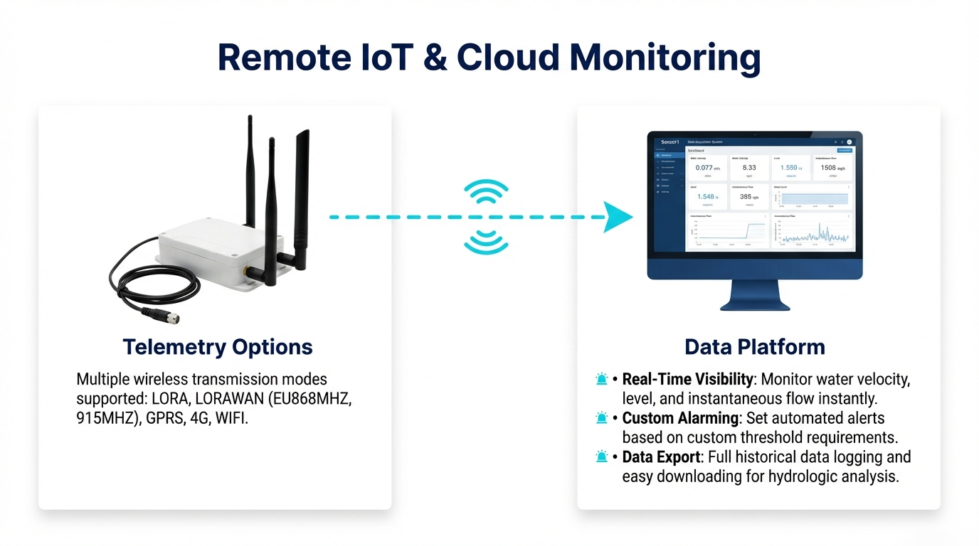
- Wireless Versatility: The sensor supports a wide array of transmission modules, including 4G, WIFI, GPRS, LORA, and LORAWAN (EU868MHZ, 915MHZ), ensuring connectivity even in remote areas with limited cellular coverage.
- Cloud-Based Management: Matching server software provides a comprehensive dashboard for real-time data visualization, historical data downloads, and the configuration of custom alarms to trigger flood alerts instantly.
6. Application Scenarios: From Urban Networks to Regional Dams
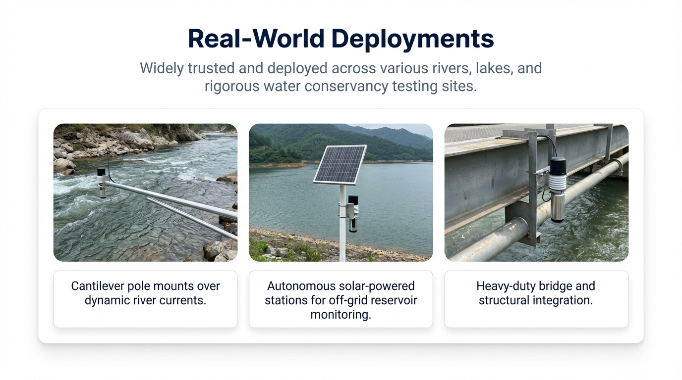
- River and Open Channel Monitoring: Real-time tracking of water levels during the monsoon season provides the critical data needed for community flood evacuation and river basin management.
- Dam and Reservoir Management: The precision of the 80GHz signal allows for exact water volume calculations, facilitating more efficient irrigation distribution and hydroelectric power generation.
- Underground Pipe Networks: Due to its compact size (heights ranging from 80.6mm to 95.4mm depending on the model), the sensor is easily installed in urban drainage systems to monitor for blockages and waterlogging.
- Remote Solar-Powered Stations: Utilizing brackets or threads, the sensor is often paired with solar-powered wireless stations for autonomous monitoring in remote provincial areas where grid power is unavailable.
7. Conclusion: The Future of Indonesian Water Management
For Indonesia to achieve a resilient hydrological future, the adoption of high-precision, low-maintenance sensing technology is essential. The 80GHz FMCW radar sensor—with its ±1mm accuracy, narrow 6° beam, and non-contact maintenance capabilities—provides a technical solution that thrives in the face of tropical environmental challenges. By prioritizing accurate data acquisition today, Indonesian water authorities can better protect infrastructure, optimize resources, and ensure the safety of communities nationwide.
For more Hydrological radar level gauge information,
please contact Honde Technology Co., LTD.
WhatsApp: +86-15210548582
Email: info@hondetech.com
Company website: www.hondetechco.com
Post time: Mar-05-2026