
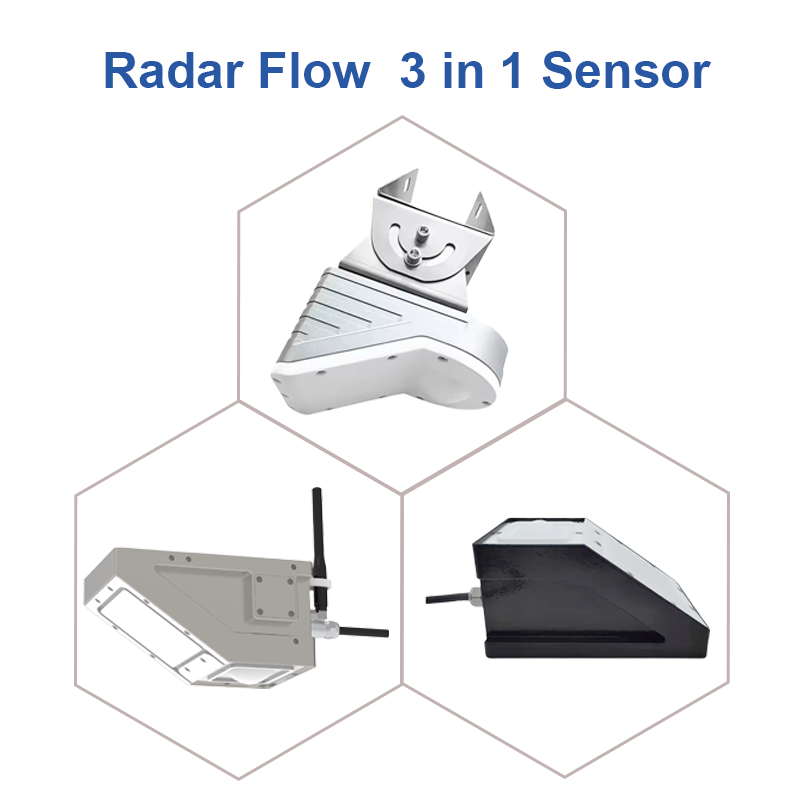
Seeing “Three-in-One” at a Glance
Traditional hydrological monitoring requires separate installation of water level gauges, flow velocity meters, and flow calculation devices, leading to fragmented data and complex maintenance. The Radar 3-in-1 technology, using millimeter-wave radar, achieves:
Non-contact Measurement: Radar devices are mounted on bridges or riverbanks, not touching the water, unaffected by debris or sediment
- Three-Parameter Synchronization:
- Surface Velocity: Precisely measured via the Doppler effect.
- Water Level: Calculated from radar wave reflection time.
- Instantaneous Discharge: Computed in real-time based on velocity profile models.
- All-Weather Operation: Unaffected by rain, fog, or darkness, enabling 24/7 continuous monitoring.
Real-World Application Cases
Case 1: Flood Control System in the Middle Reaches of China’s Yangtze River
- Deployment: 3 key sections downstream of the Three Gorges Dam.
- Tech Specs: K-band radar, RS485/4G dual transmission.
- Results: During the 2022 flood season, the system provided 6-12 hour advance warnings for 5 flood peaks, securing critical time for downstream city preparedness. A demonstration video on YouTube garnered over 500,000 views.
Case 2: Mississippi River Basin, USA
- Innovation: LoRaWAN mesh networking for grid monitoring across a 200-km river stretch.
- Outcome: Monitoring costs reduced by 40%, data refresh rate improved from hourly to minute-level. This case was widely discussed in the hydraulic engineering community on LinkedIn, becoming a benchmark for smart water management.
Case 3: Ganges Delta, Bangladesh
- Challenge: Flat terrain, rapidly changing water levels, weak infrastructure.
- Solution: Solar-powered radar monitoring stations transmitting data via satellite link.
- Social Impact: The system extended local flood warning time from less than 2 hours to over 6 hours. Related coverage was shared over 100,000 times on Facebook, drawing attention from international organizations.
Technology Advantage Comparison
| Monitoring Method | Parameter Completeness | Maintenance Need | Anti-interference Ability | Warning Lead Time |
|---|---|---|---|---|
| Traditional Staff Gauge | Level only | Manual reading | Easily obstructed | 1-2 hours |
| Pressure Sensor | Level only | Requires sediment cleaning/calibration | Affected by silt | 2-3 hours |
| Acoustic Doppler Profiler | Velocity + Level | Requires submerged installation | Vulnerable to debris | 3-4 hours |
| Radar 3-in-1 System | Velocity + Level + Discharge | Almost maintenance-free | Strong | 6-12 hours |
Data-Driven Intelligent Warning
Modern radar systems are not just sensors; they are intelligent decision nodes:
- Real-time Modeling: Builds river hydrodynamic models based on continuous discharge data.
- Trend Prediction: Uses machine learning algorithms to identify turning points in water level rise.
- Multi-source Data Fusion: Integrates rainfall data from weather radar for “rainfall-runoff-river” process prediction.
A dynamic data visualization shared by Dutch water authorities on Twitter showed how the radar system predicted a dike breach risk in a Rhine tributary 7 hours in advance. The tweet received over 50,000 likes.
Future Outlook: From Monitoring to Digital Twin
- 5G + Edge Computing: Enables local flood simulation at monitoring points for second-level warnings.
- Satellite-Ground Radar Synergy: Fuses ground radar data with Synthetic Aperture Radar (SAR) satellite data for basin-scale monitoring.
- Public Engagement Platforms: Uses platforms like TikTok to release real-time flood risk animations, raising public awareness.
Conclusion
As floods remain a leading global natural disaster, technological innovation provides us with ever-stronger defensive tools. The Hydrological Radar 3-in-1 Monitoring System represents not just an advancement in measurement technology, but a shift in disaster prevention philosophy—from “reactive response” to “proactive defense.” In an era of intensifying climate change, such technology may well be the key to harmonious coexistence with nature.
Multi-Platform Distribution Strategy
1. Video Content Plan
- YouTube/Vimeo (3-5 minutes):
- Opening: Contrasting real flood scenes with warning timelines.
- Core: Close-ups of radar operation + Data visualization animation.
- Case Study: Engineer interview + Actual warning timeline.
- Closing: Future of the technology.
- TikTok/Reels (60 seconds):
- Fast-cut sequence: Radar installation → Data fluctuation → Warning issued → Evacuation.
- Caption highlight: “What does an 8-hour warning mean? It means 5000 people can be evacuated.”
2. Visual & Text Content Design
- Facebook/Pinterest:
- Infographic: Traditional monitoring vs. Radar 3-in-1 comparison.
- Timeline: Evolution of warning lead times in major flood events.
- Interactive Q&A: “Does your city have a flood warning system?”
- LinkedIn:
- Whitepaper Summary: Technical parameters and ROI analysis.
- Industry Insight: Global trends in flood control technology.
- Expert Roundtable Discussion Invitation.
3. Engagement & Call-to-Action
- Hashtags: Unified use of #FloodTech #RadarMonitoring #WaterSecurity.
- Data Visualization: Create a live flood monitoring map accessible to the public.
- Expert Sessions: Host a Q&A on flood tech via Twitter Spaces.
- Case Study Collection: Encourage water authorities globally to share application experiences.
4. Media Partnership Suggestions
- Trade Media: Pitch to academic publications like Nature Water.
- Mass Media: Produce科普 animations for weather channels.
- Government Collaboration: Create short explainer videos for water resource departments.
Expected Reach & Engagement
| Platform | Core KPI | Target Audience |
|---|---|---|
| 100K+ Impressions, 5K+ Engagements | Tech enthusiasts, Disaster prevention experts | |
| YouTube | 500K+ Views, 10K+ Likes | Engineering professionals, Students |
| 500+ Professional Comments, 100+ Shares | Hydraulic engineers, Government officials | |
| 200K+ Reach, 10K+ Shares | General public, Community organizations | |
| TikTok | 1M+ Plays, 100K+ Likes | Younger demographics, Science communication enthusiasts |
Through this multi-layered, multi-format content strategy, the Hydrological Radar 3-in-1 technology can gain professional recognition while entering the public consciousness, driving societal awareness of flood control technology and ultimately realizing its dual value in both technical and social terms.
Complete set of servers and software wireless module, supports RS485 GPRS /4g/WIFI/LORA/LORAWAN
For more radar sensor information,
please contact Honde Technology Co., LTD.
Email: info@hondetech.com
Company website: www.hondetechco.com
Tel: +86-15210548582
Post time: Dec-22-2025