
Project Background
Southeast Asia, characterized by its tropical monsoon climate, faces severe flood threats annually during the rainy season. Using the “Chao Phraya River Basin” in a representative country as an example, this basin flows through the nation’s most densely populated and economically developed capital and surrounding regions. Historically, the interplay of sudden torrential rains, rapid runoff from upstream mountainous areas, and urban waterlogging has made traditional, manual, and experience-based hydrological monitoring methods inadequate, often leading to untimely warnings, significant property damage, and even casualties.
To shift from this reactive approach, the national water resources department, in collaboration with international partners, launched the “Integrated Flood Monitoring and Early Warning System for the Chao Phraya River Basin” project. The goal was to establish a real-time, accurate, and efficient modern flood control system leveraging IoT, sensor technology, and data analytics.
Core Technologies and Sensor Applications
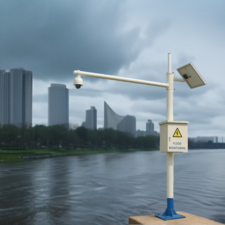
The system integrates various advanced sensors, forming the “eyes and ears” of the perception layer.
1. Tipping Bucket Rain Gauge – The “Frontline Sentinel” for Flood Origins
- Deployment Locations: Widely deployed in upstream mountainous areas, forest reserves, medium-sized reservoirs, and key catchment areas on the urban periphery.
- Function and Role:
- Real-time Rainfall Monitoring: Collects rainfall data every minute, with an accuracy of 0.1 mm. Data is transmitted in real-time to the central control center via GPRS/4G/satellite communication.
- Storm Warning: When a rain gauge records extremely high-intensity rainfall in a short period (e.g., over 50 mm in one hour), the system automatically triggers an initial alert, indicating a risk of flash floods or rapid runoff in that area.
- Data Fusion: Rainfall data is one of the most critical input parameters for hydrological models, used to predict runoff volume into rivers and the arrival time of flood peaks.
2. Radar Flow Meter – The River’s “Pulse Monitor”
- Deployment Locations: Installed at all major river channels, key tributary confluences, downstream of reservoirs, and on critical bridges or towers at city entrances.
- Function and Role:
- Non-Contact Velocity Measurement: Uses radar wave reflection principles to accurately measure surface water velocity, unaffected by water quality or sediment content, requiring low maintenance.
- Water Level and Cross-Section Measurement: Combined with built-in pressure water level sensors or ultrasonic water level gauges, it obtains real-time water level data. Using pre-loaded river channel cross-sectional topography data, it calculates real-time flow rate (m³/s).
- Core Warning Indicator: Flow rate is the most direct indicator for determining flood magnitude. When the flow monitored by the radar meter exceeds preset warning or danger thresholds, the system triggers alerts at different levels, buying crucial time for downstream evacuation.
3. Displacement Sensor – The “Safety Guardian” for Infrastructure
- Deployment Locations: Critical levees, embankment dams, slopes, and riverbanks prone to geotechnical hazards.
- Function and Role:
- Structural Health Monitoring: Uses GNSS (Global Navigation Satellite System) displacement sensors and in-place inclinometers to continuously monitor millimeter-level displacement, settlement, and tilt of dikes and slopes.
- Dam/Break Failure Warning: During floods, rising water levels exert immense pressure on hydraulic structures. Displacement sensors can detect early, subtle signs of structural instability. If the rate of displacement change suddenly accelerates, the system immediately issues a structural safety alert, preventing catastrophic floods caused by engineering failures.
System Workflow and Achieved Outcomes
- Data Acquisition and Transmission: Hundreds of sensor nodes throughout the basin collect data every 5-10 minutes and transmit it in packets to the cloud data center via an IoT network.
- Data Fusion and Model Analysis: The central platform receives and integrates multi-source data from rain gauges, radar flow meters, and displacement sensors. This data is fed into a calibrated coupled hydro-meteorological and hydraulic model for real-time flood simulation and forecasting.
- Intelligent Early Warning and Decision Support:
- Scenario 1: Rain gauges in the upstream mountains detect a severe storm; the model immediately predicts a flood peak exceeding the warning level will reach Town A in 3 hours. The system automatically sends a warning to Town A’s disaster prevention department.
- Scenario 2: The radar flow meter on the river passing through City B shows a rapid flow rate increase within an hour, with water levels about to overtop the levee. The system triggers a red alert and issues urgent evacuation orders to riverside residents via mobile apps, social media, and emergency broadcasts.
- Scenario 3: Displacement sensors on an old section of levee at Point C detect abnormal movement, prompting the system to flag a risk of collapse. The command center can immediately dispatch engineering teams for reinforcement and pre-emptively evacuate residents in the risk zone.
- Application Outcomes:
- Increased Warning Lead Time: Compared to traditional methods, the flood warning lead time improved from 2-4 hours to 6-12 hours.
- Enhanced Decision-Making Scientific Rigor: Scientific models based on real-time data replaced experience-based fuzzy judgment, making decisions like reservoir operation and flood diversion area activation more precise.
- Reduced Losses: In the first flood season after system deployment, it successfully managed two major flood events, estimated to have reduced direct economic losses by approximately 30% and achieved zero casualties.
- Improved Public Engagement: Through a public mobile application, citizens can check real-time rainfall and water level information in their vicinity, enhancing public disaster prevention awareness.
Challenges and Future Outlook
- Challenges: High initial system investment; communication network coverage in remote areas remains problematic; long-term sensor stability and vandalism resistance require ongoing maintenance.
- Future Outlook: Plans include introducing AI algorithms to further improve forecast accuracy; integrating satellite remote sensing data to expand monitoring coverage; and exploring deeper linkages with urban planning and agricultural water use systems to build a more resilient “Smart River Basin” management framework.
Summary:
This case study demonstrates how the synergistic operation of Tipping Bucket Rain Gauges (sensing the source), Radar Flow Meters (monitoring the process), and Displacement Sensors (safeguarding infrastructure) builds a comprehensive, multi-dimensional flood monitoring and early warning system—from “sky” to “ground,” from “source” to “structure.” This not only represents the modernization direction of flood control technology in Southeast Asia but also provides valuable practical experience for global flood management in similar river basins.
Complete set of servers and software wireless module, supports RS485 GPRS /4g/WIFI/LORA/LORAWAN
please contact Honde Technology Co., LTD.
Email: info@hondetech.com
Company website: www.hondetechco.com
Tel: +86-15210548582
Post time: Sep-29-2025