

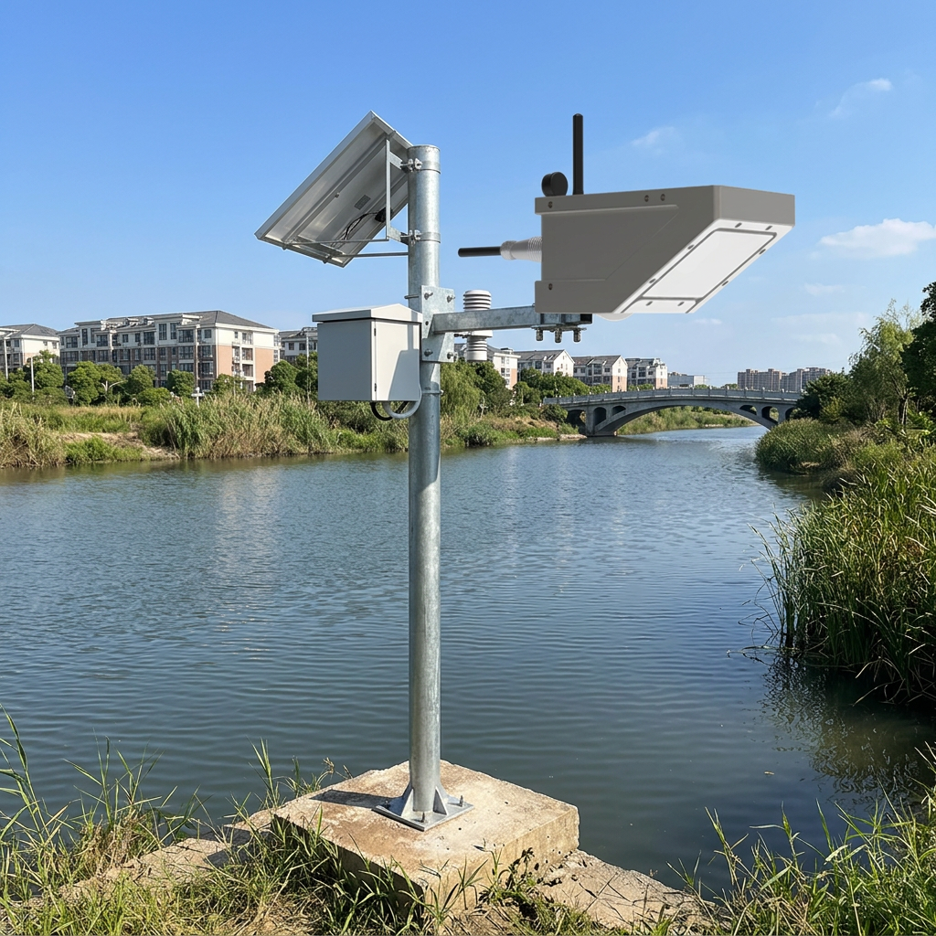
This is the physical environment where Australia’s AS4747:2025 metering standard now requires continuous, tamper-proof, telemetry-enabled flow measurement at every regulated surface-water offtake in the Murray-Darling Basin. The standard does not specify a particular sensor technology. It specifies outcomes: accuracy within ±2.5% under field conditions, tamper-evident or tamper-proof physical design, and data transmission at minimum daily frequency to a state-government telemetry platform.
In the northern Basin — the Barwon-Darling, the Gwydir, the Namoi, the Macquarie — the combination of intermittent flow, debris loading, and remote locations eliminates most technologies from consideration. Submerged ultrasonic meters are destroyed by debris. Mechanical flow meters are destroyed by debris and also fail the tamper-proof requirement — a gate can be opened around them. Pressure-differential devices require a physical flume or weir, which costs
50,000to200,000 to construct and accumulates sediment during dry periods.
The technology that survives all of these constraints is non-contact radar. Honde Technology’s CE-certified 3-in-1 radar flow meter — measuring surface velocity, water level, and computed volumetric flow rate from a gantry above the water — is now operating at 45 offtakes in the northern Murray-Darling Basin under AS4747 compliance upgrades.
Why Radar, and Why Non-Contact Specifically Matters Here
The Barwon-Darling’s flow regime is the reason. A submerged sensor that sits in a dry channel for 18 months accumulates dust, spider webs, and corrosion on its transducer face. When the flow arrives, the sensor’s first readings are typically inaccurate for the first 24 to 48 hours — precisely the window when accurate measurement matters most, because that is when the water is being diverted into on-farm storages. By the time the sensor stabilizes, 40% of the flow event may have already passed.
The Honde radar sits on a steel gantry 4 to 10 meters above the channel bed. During the 18-month dry period, it does nothing. It does not degrade. When the flow arrives, its first reading is as accurate as its thousandth. The 24GHz Doppler component captures surface velocity from the moment a detectable current exists. The 60GHz or 80GHz level radar captures water stage with ±2mm precision. The onboard processor integrates velocity, level, and the channel’s surveyed cross-sectional geometry to calculate instantaneous flow rate in megaliters per day — the unit that Australian water accounting uses.
The cross-sectional geometry input is not a one-time estimate. The channel profile at each offtake is surveyed at installation and entered into the sensor’s configuration. If the channel shifts — as earthen channels in the black-soil plains of the Gwydir Valley do, particularly after major flood events — the survey is updated and the new profile is uploaded via the RS485 Modbus interface. The sensor does not assume a stable geometry. It accepts a new geometry whenever the physical channel changes.
The Tamper-Proof Logic
The AS4747 standard’s emphasis on tamper-proofing is a direct response to the 2017–2019 water theft allegations in the northern Basin, where irrigators were accused of pumping during embargo periods and manipulating metering equipment. A non-contact radar sensor mounted 6 meters above a canal on a steel gantry cannot be physically blocked, submerged in a bucket of still water, or bypassed with a hidden pipe. The gantry is visible from the air and auditable by satellite imagery cross-referenced against the telemetry data.
The data stream itself is tamper-evident. Each 15-minute measurement is timestamped, geotagged, and transmitted directly to the state government’s telemetry platform — the NSW WaterInsights portal or Queensland’s IWMS — via MQTT Json. There is no local override. There is no manual editing interface. The offtake operator can view the data. They cannot modify it.
This matters because the Murray-Darling Basin Plan, the $13 billion intergovernmental agreement that governs water sharing between New South Wales, Victoria, South Australia, and Queensland, depends on auditable accounting. If the water extracted at an offtake in the Gwydir Valley is measured with ±2.5% accuracy and transmitted to a government platform within 24 hours, the downstream environmental flow allocation to the Macquarie Marshes can be calculated with confidence. If the measurement is ±20% and the data arrives on a paper form three months late, the entire accounting framework is undermined. The non-contact radar closes that gap.
Connectivity: What “Remote” Means in the Australian Outback
The northern Basin is not simply rural. It is remote on a scale that European sensor networks do not encounter. A cotton farm offtake on the Barwon-Darling near Brewarrina is 120 kilometers from the nearest town with a population over 5,000. Cellular coverage exists along the Kamilaroi Highway. It does not exist 40 kilometers off the highway on a dirt track leading to a river pump.
The 45 Honde radar units in the AS4747 compliance deployment connect to telemetry platforms through communication modules selected per site. Offtakes within 15 kilometers of a town — Moree, Narrabri, Walgett, Bourke — use 4G modules. Offtakes in cellular dead zones use LoRaWAN modules that relay data to gateways on nearby grain silos or Telstra towers, with 15- to 25-kilometer range across the flat terrain. Three offtakes in the most remote sections of the Paroo River system use satellite backhaul integrated with the LoRaWAN gateway.
At the offtake level, the irrigator does not interact with the cloud. A Data logger with screen mounted in the pump-shed control room displays the current flow rate in megaliters per day, the cumulative daily extraction volume, and a 30-day trend. The irrigator checks the logger as part of their daily operational routine — the same way they check pump pressure and fuel levels.
During the annual compliance audit, a technician from WaterNSW verifies each sensor against a portable Handmeter and, where conditions permit, a mechanical current meter lowered from a boat or bridge. The calibration record is uploaded to the same MQTT stream and becomes part of the permanent audit trail.
The Alarm Logic: When Extraction Exceeds Allocation
The Murray-Darling Basin operates on a water-allocation system. Each irrigator holds an annual entitlement, and each year the state government announces an allocation percentage based on storage levels. In a wet year, allocations may reach 100%. In a dry year, they may be zero for general-security users.
The 3-in-1 radar sensor’s continuous volumetric measurement enables a function that manual metering never could: real-time allocation enforcement. The Cloud server and software tracks cumulative extraction for each offtake against its allocated volume. When cumulative extraction reaches 95% of allocation, the Alarm relay system sends an automated notification to the irrigator — a warning that extraction is approaching the legal limit. At 100% of allocation, the relay can trigger a physical pump shutdown if the offtake’s control system is configured for automated compliance.
In the 2025–2026 water year, which saw below-average inflows across the northern Basin, this automated allocation tracking is not a convenience feature. It is the enforcement mechanism that replaces the previous system of self-reported meter readings and random compliance audits. The data is not self-reported. It is automated, timestamped, and transmitted directly to the state regulator.
Field Results: Northern Basin, NSW, January–July 2026
An initial deployment of 45 CE-certified 3-in-1 radar flow meters was commissioned between January and March 2026 across regulated offtakes in the Gwydir, Namoi, and Barwon-Darling valleys.
Operational results after six months:
- Zero sensor failures through the 2025–2026 summer irrigation season, including a January heatwave that recorded 47°C ambient temperatures at the Brewarrina offtakes and a March flow pulse that transitioned the Barwon-Darling from dry to 2,800 megaliters per day in under 72 hours. The non-contact radar survived the transition without physical stress.
- Accuracy verification against mechanical current-meter measurements at 8 of the 45 sites returned a mean deviation of ±3.1% — within the ±2.5% target at 6 of 8 sites, with the remaining two sites requiring channel-profile resurveys after the March flood event reshaped the offtake cross-section.
- The Alarm relay system triggered three allocation-exhaustion pump shutdowns during the irrigation season. At each of the three sites, the irrigator had not independently tracked cumulative extraction and would have exceeded allocation by an estimated 8–15% under the previous self-reporting system.
- The MQTT Json telemetry stream achieved 97.3% data completeness across all 45 sites — exceeding the 95% minimum specified under AS4747:2025. The 2.7% data gap was concentrated in a 6-day period in February when a regional Telstra outage affected 4G connectivity at 7 sites. The LoRaWAN sites were unaffected.
- Based on the deployment’s performance, the NSW Department of Climate Change, Energy, the Environment and Water has approved an expansion to an additional 120 offtakes in the northern Basin, with procurement expected to begin in Q3 2026.
Contact Honde Technology for Hydrological Metering Solutions
Honde Technology is a Germany TUV & Alibaba verified manufacturer. We supply the non-contact radar flow measurement hardware, the multi-protocol telemetry architecture, and the tamper-proof data platforms required for Australia’s AS4747-compliant water metering networks.
For more sensor information and customized IoT solutions, please contact Honde Technology Co., LTD.
- WhatsApp: +86-15210548582
- Email: info@hondetech.com
- Company Website: www.hondetechco.com
Post time: Aug-04-2026