

Flood risk at dams, levees, reservoirs and other water infrastructure rarely comes from a single measurement. Heavy rainfall can rapidly change water levels, while slope movement or structural displacement may develop at the same time. If these signals are monitored separately—or checked only during periodic inspections—important changes can be missed between observations.
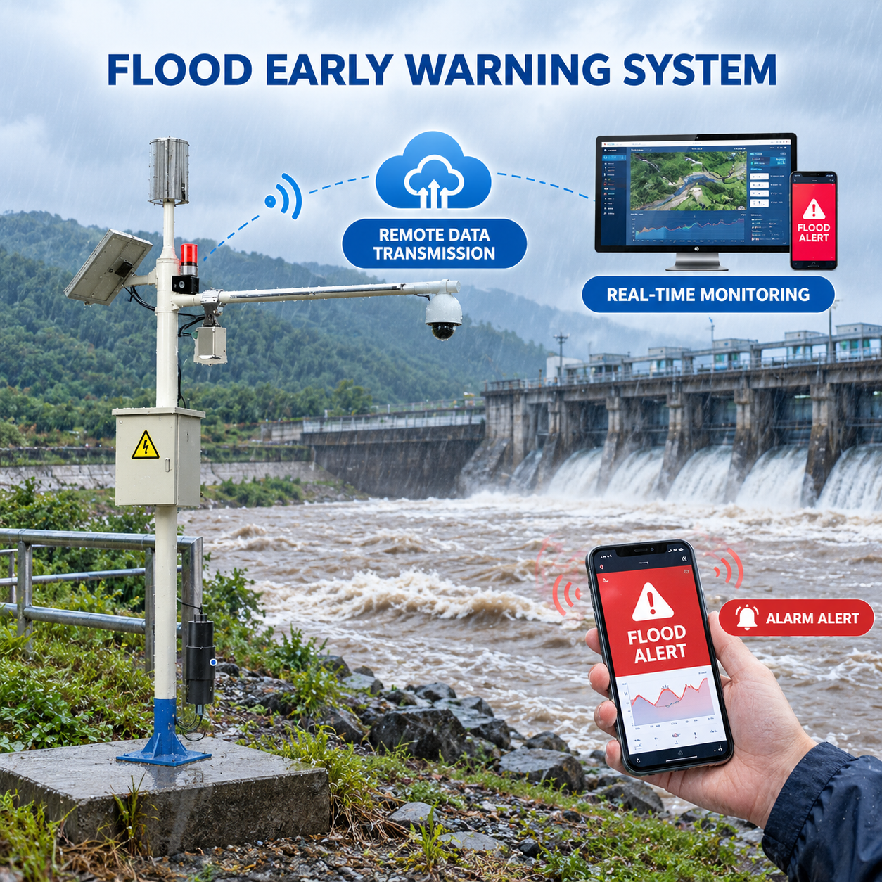
Honde Technology’s integrated flood monitoring approach combines water level, rainfall and displacement monitoring in one field-deployed system. The solution can collect data locally, transmit measurements through wired or wireless communication, display real-time and historical data on a cloud platform, and activate an alarm relay when configured conditions are reached.
Why Integrated Flood Monitoring Matters
Traditional monitoring arrangements often rely on several instruments, manual inspections or single-parameter sensors. Each method can provide useful information, but the data may not share the same timestamp or reach the response team through the same alarm chain.
An integrated monitoring node brings three important measurements together:
- Water level: non-contact 80 GHz FMCW radar monitoring.
- Rainfall: 0.2 mm resolution tipping-bucket measurement.
- Displacement: draw-wire monitoring for slope or structural movement.
Combining these measurements provides a clearer picture of changing site conditions. Instead of relying on one indicator, operators can review rainfall, water level and displacement data together and configure site-specific alarm thresholds.
Three Core Monitoring Functions in One System
1. Non-Contact 80 GHz Radar Water Level Monitoring
The radar water level sensor uses 80 GHz FMCW technology and provides a measurement range of up to 7 m, with an accuracy specification of ±1 mm / ±2 mm depending on configuration. The non-contact design keeps the sensing element out of the water, making it suitable for applications where sediment, debris or difficult access can increase maintenance requirements.
The radar sensor supports 4–20 mA output and operates from 7–32 V DC. Its IP68 protection rating and operating temperature range of −40 °C to +85 °C support outdoor monitoring installations.
2. 0.2 mm Precision Rainfall Monitoring
The integrated tipping-bucket rain gauge provides 0.2 mm resolution and can output a reed-switch pulse signal or RS485. The stainless-steel housing is designed for outdoor deployment, while the system can transmit rainfall data together with water level and displacement measurements.
When rainfall intensity changes rapidly, continuous rainfall data can provide useful context for interpreting rising water levels and other site measurements.
3. Draw-Wire Displacement Monitoring
The draw-wire displacement sensor supports a measurement range of 100 mm to 35,000 mm, with a specified linearity of ±0.25% FS and repeatability of ±0.05% FS.
This measurement channel can be used to monitor movement associated with slopes, embankments or other structures where displacement data is part of the site’s flood or safety monitoring strategy.
System Specifications
| Subsystem | Specification |
|---|---|
| Radar Water Level Sensor | Up to 7 m range; ±1 mm / ±2 mm accuracy; 80 GHz FMCW; 7–32 V DC; 4–20 mA; IP68; −40 °C to +85 °C |
| Tipping Bucket Rain Gauge | 0.2 mm resolution; ≤4 mm/min maximum rainfall rate; reed-switch pulse or RS485; stainless-steel housing |
| Draw-Wire Displacement Sensor | 100–35,000 mm range; ±0.25% FS linearity; ±0.05% FS repeatability; SUS304 cable |
| Wireless Communication | LoRa, LoRaWAN, GPRS, 4G and WiFi options |
| Wired Outputs | 0–5 V, 0–10 V, 4–20 mA and RS485 |
| Certification / Warranty | CE, RoHS; 1-year warranty; MOQ 1 piece |
Flexible Deployment for Different Dam and Flood Monitoring Projects
1. Handmeter and Data Logger with Screen
For commissioning, inspection and remote field work, the monitoring node can be used with a handmeter or data logger with a display. Operators can view level, rainfall and displacement readings locally and store timestamped measurements for later review.
2. Wireless Monitoring with MQTT JSON
For remote sites, Honde supports GPRS, 4G, WiFi, LoRa and LoRaWAN communication options. Data can be transmitted using MQTT JSON, providing a standardized data format for integration with monitoring platforms and existing IoT or SCADA architectures.
LoRaWAN can be used for long-range low-power communication in suitable remote deployments, while 4G can be selected where cellular coverage is available and additional remote data services are required.
3. Cloud Server, Historical Data and Alarm Relay
The cloud server and software provide access to real-time and historical monitoring data. Site-specific thresholds can be configured for rainfall, water level and displacement.
When configured conditions are reached, the physical alarm relay can be connected to external warning equipment such as a siren, warning beacon or gate controller. SMS and email notifications can also be used to alert responsible personnel.
Integrated Node vs. Separate Monitoring Points
| Monitoring Factor | Manual / Legacy Station | Single-Parameter Sensor | Integrated Monitoring Node |
|---|---|---|---|
| Parameters at the same timestamp | 1 | 1 | 3: level + rainfall + displacement |
| Water level measurement | Staff gauge | Contact probe | 80 GHz non-contact radar, IP68 |
| Rainfall resolution | Typically 0.5–1.0 mm | Typically 0.5 mm | 0.2 mm |
| Slope / displacement monitoring | Periodic survey | Not included | Draw-wire, ±0.25% FS |
| Automatic alarm | No | Application dependent | Alarm relay + SMS/email options |
| System integration | Multiple instruments | Single data source | One node, one communication bus, one monitoring platform |
Where the Solution Can Be Applied
The integrated architecture is suitable for applications where water level, rainfall and movement data need to be collected as part of a continuous monitoring strategy.
- Dams and reservoirs: water level, rainfall and embankment movement monitoring.
- Levees and embankments: continuous environmental and displacement data collection.
- Mountain flood and flash-flood monitoring: remote rainfall and water-level monitoring with wireless telemetry.
- River and catchment monitoring: remote monitoring stations connected to a central platform.
- Tailings and remote sites: solar-compatible field deployments with long-range wireless options.
- Water infrastructure: monitoring systems that require RS485, 4–20 mA or IoT connectivity.
Designed for Remote and Low-Power Deployments
Many flood monitoring sites are located far from buildings, grid power and wired communications. The system supports 7–32 V DC operation and multiple communication options, allowing the final configuration to be matched to the site’s power and network conditions.
For suitable remote installations, solar power can be combined with low-power field equipment and LoRaWAN communication. Where cellular coverage is available, GPRS or 4G can provide a direct telemetry path to the monitoring platform.
Common Questions
What is the minimum order quantity?
The stated MOQ is 1 piece, allowing a single-site pilot before a larger deployment.
Can the system connect to existing SCADA equipment?
Yes. The system supports RS485, 4–20 mA and 0–10 V wired outputs, together with MQTT JSON over supported wireless communication modules.
Can it operate at sites without reliable cellular coverage?
For suitable deployments, LoRa or LoRaWAN can be selected as the communication method. The final choice depends on site coverage, network architecture and power requirements.
What is the warranty period?
The stated warranty is 1 year. Configuration, spare parts and technical support should be confirmed for the specific project.
Can the system trigger external warning equipment?
Yes. The cloud monitoring solution can work with a physical alarm relay. Depending on the site configuration, the relay can be connected to equipment such as a siren, warning beacon or gate controller.
From Monitoring Data to an Actionable Flood Warning Workflow
- Identify the monitoring blind spot: determine which parameter is currently estimated, manually checked or measured too infrequently.
- Deploy a pilot node: start with a high-priority dam, levee, reservoir or flood-prone site.
- Configure communication: select RS485, 4–20 mA, 4G, LoRa or LoRaWAN according to the site.
- Set alarm thresholds: configure rainfall, water-level and displacement limits in the monitoring platform.
- Connect warning equipment: link the alarm relay to the site’s existing siren, beacon or other response equipment where required.
- Review and scale: evaluate the first deployment and expand the monitoring network according to project requirements.
Build a More Connected Flood Monitoring System
An effective flood monitoring system is not only about installing a water level sensor. It is about connecting water level, rainfall, displacement, communication, data storage and alarm functions into a practical monitoring workflow.
Honde Technology provides integrated sensor options, wireless communication modules, data loggers and cloud software for customized hydrological and flood monitoring projects. The system can be configured according to measurement range, communication method, power supply and site requirements.
Contact Honde Technology for product configuration, project requirements and quotation.
WhatsApp: +86-15210548582
Email: info@hondetech.com
Website: www.hondetechco.com
Post time: Sep-22-2026