

No river on Earth carries more sediment per unit of water than the Amu Darya during flood season. In July, when glacial melt from the Pamir Mountains combines with the last of the spring rains, suspended sediment concentrations at the Kerki gauging station routinely hit 3 to 5 kilograms per cubic meter. The water is the color of wet concrete. Anything submerged in it — a pressure transducer, a Doppler current meter, the steel mounting bracket itself — gets sandblasted at two meters per second for three months straight.
This is not an argument against submerged sensors. It is the reason the Uzbek Ministry of Water Resources stopped buying them for the Amu Darya’s main canal offtakes in 2023. The Soviet-era mechanical flow gauges that survived from the 1970s still work because they have no electronics and almost no moving parts besides a float and a counterweight. But they produce one data point per day — a manual reading logged by a canal operator with a clipboard. That operator cannot capture a surge from upstream reservoir releases. He cannot provide audit-grade volumetric data to resolve a transboundary water dispute with Turkmenistan. And there are fewer of those operators every year. The Soviet-trained hydraulic engineers who knew those gauges are retiring.
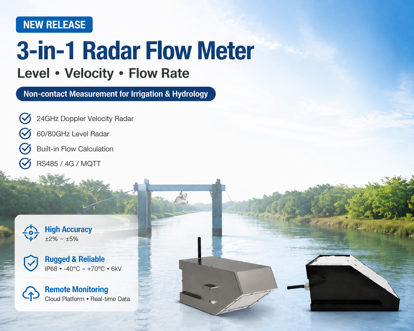
The replacement, now being piloted across 34 main canal offtakes in the Bukhara and Khorezm provinces, is the CE-certified 3-in-1 radar flow meter from Honde Technology. It sits above the water. It measures level, surface velocity, and computed flow rate from a gantry. It transmits data every 15 minutes. And it has never been buried in Amu Darya silt.
Why the Sensor Survives Where Submerged Meters Fail
The physical argument for non-contact radar in Central Asian irrigation is straightforward. A submerged sensor in an Amu Darya canal with 3 kg/m³ of suspended sediment experiences the equivalent of sandblasting at 2 m/s. The transducer face erodes. The mounting bracket fatigues. The cable sheath abrades against the canal wall. After one flood season — roughly June through September — the sensor is dead or drifting beyond its specified accuracy.
The Honde 3-in-1 radar operates entirely in the air gap above the water surface. It mounts on a galvanized gantry spanning the canal cross-section, typically 3 to 12 meters above the design water level. The 24GHz Doppler component measures surface velocity by analyzing the frequency shift of the reflected signal. The level radar — configurable as 60GHz or 80GHz depending on the canal width — measures water stage with millimeter precision. The onboard processor integrates these two measurements with the canal’s known cross-sectional geometry to calculate instantaneous volumetric flow rate in cubic meters per second.
The cross-sectional geometry input is what separates a radar flow meter from a radar level sensor with a velocity add-on. The installer enters the canal profile — trapezoidal, rectangular, or a custom surveyed cross-section — into the sensor’s configuration during commissioning. The flow calculation is not an estimate based on a Manning equation assumption. It is a direct integration of measured level, measured velocity, and known geometry. For the rectangular concrete-lined offtakes common in Uzbekistan’s pump-irrigated zones, the computation is straightforward geometry. For the earthen trapezoidal canals that dominate gravity-fed districts, the operator inputs the surveyed cross-section at the measurement point. The sensor recalculates wetted area at each measurement interval as the water level changes.
This matters for transboundary accounting. A flow measurement derived from a staff gauge reading and a rating curve — the Soviet-era method — carries an uncertainty of ±15% to ±25%. A radar integration of measured level and measured velocity across a known cross-section carries an uncertainty of ±2% to ±5%, depending on surface turbulence. When Uzbekistan and Turkmenistan negotiate Amu Darya allocations under the Interstate Commission for Water Coordination, that difference is the gap between a diplomatic argument and a settled transaction.
The Physical Environment: What “-25°C to +65°C” Actually Means
Uzbekistan’s climate does not offer mild operating conditions. The Karakalpakstan region along the lower Amu Darya hits -25°C in January. The same canal offtake that froze solid in winter will carry 40 cubic meters per second of 28°C water in July. The sensor’s CE certification covers an operating range from -40°C to +70°C. That is not a conservative margin. That is the minimum required to survive one calendar year.
The 6000V surge protection is also non-negotiable. Central Asia’s irrigation districts experience frequent lightning during the spring and autumn storm transitions. A sensor mounted on a metal gantry above a flat canal in open steppe is effectively a lightning rod. The integrated surge suppression has to absorb strikes that would vaporize unprotected electronics.
The housing is IP68-rated. The cable gland connections are double-sealed. These specifications do not appear on most procurement checklists until a sensor fails. Then they become the only specifications that matter.
How the Network Operates Across 34 Canal Offtakes
Uzbekistan’s irrigation districts are vast. The Amu-Bukhara Machine Canal alone stretches 234 kilometers from the river intake to the Bukhara oasis, feeding secondary canals that distribute water across 400,000 hectares of cotton, wheat, and horticultural land. The distance from the most remote offtake to the district water office can exceed 80 kilometers. Cellular coverage exists along the main highways and near towns. It does not exist in the middle of the Kyzylkum Desert.
The 34 Honde 3-in-1 units in the pilot deployment connect to the cloud through communication modules selected per site. Offtakes near provincial centers — Bukhara city, Urgench, Nukus — use 4G modules. Offtakes in the desert, 40 kilometers from the nearest tower, use LoRaWAN modules that relay data to a gateway on the district water office roof. All data is packetized in MQTT Json and fed into the Ministry of Water Resources’ central water-accounting platform in Tashkent.
At the local level, the canal operator does not interact with a cloud dashboard. He interacts with a Data logger with screen mounted in the offtake control room — a small brick building that also houses the motorized gate controls and the electrical panel. The screen shows the current flow rate, the cumulative daily volume, and a 30-day trend. If the cellular network is down, the operator still has the data. If the LoRaWAN gateway is down, the operator still has the data. The logger stores 90 days of fifteen-minute interval records. When the connection restores, it backfills the cloud.
During quarterly maintenance rounds, a technician from the Basin Irrigation System Authority verifies each sensor against a portable Handmeter and a mechanical current meter lowered from the gantry. The verification takes under 10 minutes per site. The technician does not need a laptop.
The Relay Logic: Why an Automatic Gate Closure Matters
The most consequential component in the pilot is not the radar sensor. It is the alarm relay wired to the motorized sluice gate.
Here is the operational scenario. A downstream irrigation district has an allocated daily volume of 120,000 cubic meters from a specific offtake, based on the Interstate Commission’s seasonal water-sharing agreement. Under the Soviet-era system, the canal operator manually adjusted the gate based on a daily staff-gauge reading and a paper allocation schedule. If the operator was sick, or if the upstream reservoir released more water than scheduled, the district received more than its allocation. The downstream district on the same canal received less. No data existed to prove either condition. The dispute lasted until the next Commission meeting, where it was resolved by political negotiation rather than hydrological evidence.
Under the Honde system, the cloud platform tracks cumulative daily volume at each offtake in real time. When the volume reaches the allocated limit, the Alarm relay system triggers a signal to the motorized gate controller. The gate closes automatically. The downstream district receives its full allocation because the upstream district cannot exceed its own. The data is transparent, timestamped, and accessible to both parties — and to the Interstate Commission — through the Cloud server and software that consolidates real-time data and history data from every monitored offtake in the basin.
In the first three months of the pilot, the relay triggered automated gate closures 17 times across eight offtakes. Each closure represented a situation where, under the manual system, an overallocation would have gone undocumented. The downstream districts that benefited from those closures reported — for the first time in years — that their allocated water actually arrived.
Field Results: Bukhara and Khorezm Provinces, April–July 2026
The pilot deployment of 34 Honde CE-certified 3-in-1 radar flow meters was commissioned in April 2026 across the Amu-Bukhara Machine Canal and the Tashsaka Canal in Khorezm.
Hardware: 34 3-in-1 radar flow meters on steel gantries over concrete-lined and earthen offtakes ranging from 4 to 18 meters in width.
Transmission: 4G at 22 sites with cellular coverage; LoRaWAN at 12 remote desert sites. All MQTT Json to the Ministry’s platform in Tashkent.
Local: Data logger with screen at each control room. Handmeter verification during quarterly rounds.
Alarm: Relay modules on the eight offtakes with motorized sluice gates.
Operational results after 100 days:
- Zero sensor failures through the peak of the 2026 flood season, including a July sediment pulse that reached 4.2 kg/m³ at the main canal intake. The non-contact radar recorded the entire event while two comparison pressure transducers at the same sites were buried and destroyed.
- The 34 offtakes achieved an aggregate volumetric accounting accuracy of ±3.8% compared to downstream check measurements — a margin approximately five times tighter than the manual staff-gauge and rating-curve method.
- The Alarm relay system enforced 17 automated gate closures that prevented an estimated 260,000 cubic meters of unauthorized water diversions over the pilot period — water that instead reached downstream districts in Turkmenistan and Karakalpakstan.
- The MQTT Json data stream enabled the Interstate Commission to review August allocation compliance within 24 hours of month-end instead of the typical 45-day delay required to collect and reconcile paper logbooks from 34 separate offtakes.
- Based on reduced water losses and improved downstream delivery reliability, the Basin Irrigation System Authority has recommended expanding the network to 120 additional offtakes in 2027, contingent on continued World Bank financing.
Contact Honde Technology for Irrigation Modernization Tenders
For more sensor information and customized IoT solutions, please contact Honde Technology Co., LTD.
- WhatsApp: +86-15210548582
- Email: info@hondetech.com
- Company Website: www.hondetechco.com
Post time: Jul-31-2026