

Here is something satellite altimetry will not tell you about Lake Victoria: on June 22 this year, a windstorm pushed a 45-centimeter water surge into a fishing village on Uganda’s Kalangala shoreline. The satellite that passes over the lake every 10 days wasn’t overhead. By the time the next altimetry reading confirmed the lake level, 17 families had already been evacuated by boat in the dark. The water had already started receding.
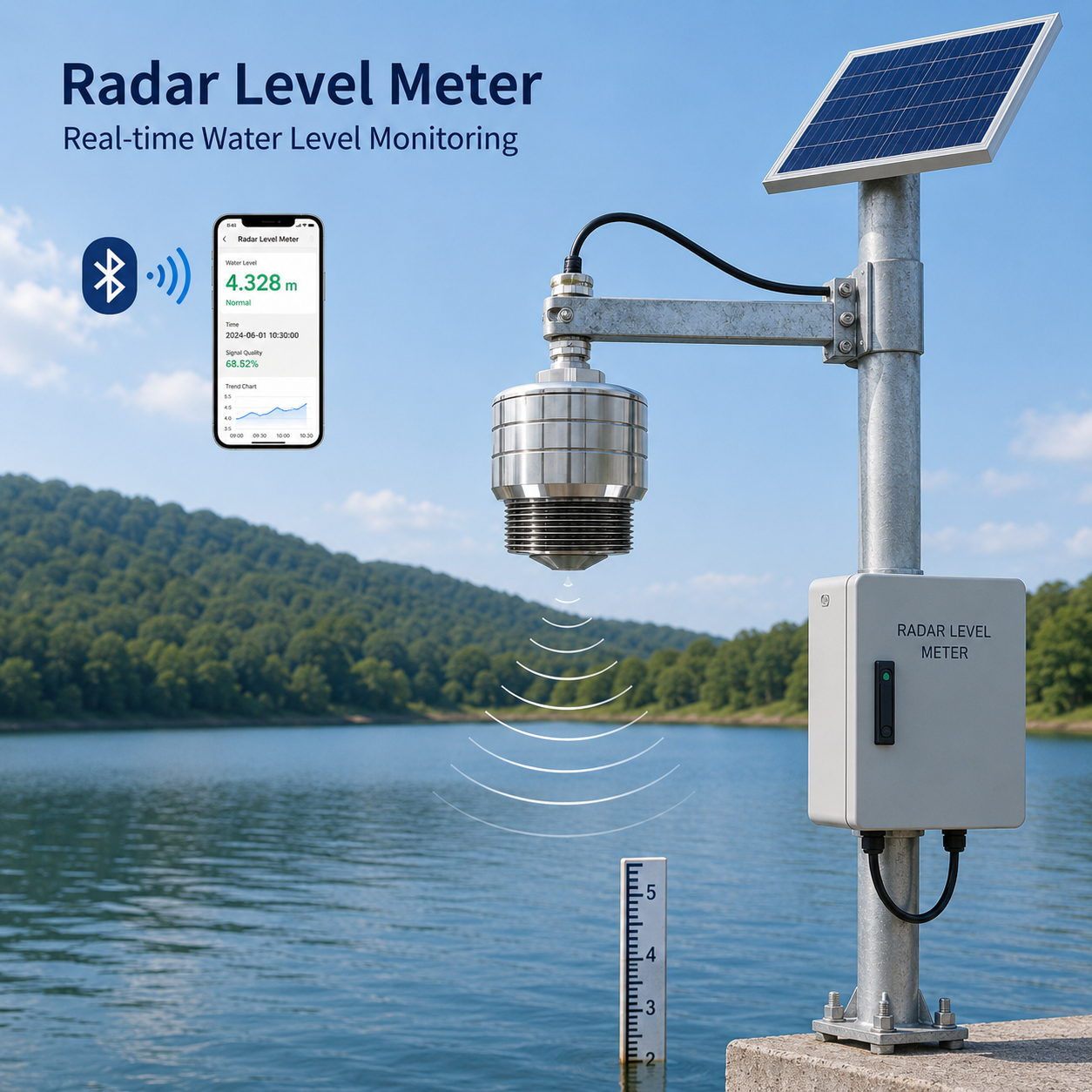
This is the gap a network of 40 wireless radar sensors is trying to close.
Lake Victoria’s monitoring problem is not about the total lake level. That number — 1,137.29 meters above sea level at the 2021 peak, about 1.31 meters above the 1964 record — is well documented. The problem is what happens between satellite passes. Lakes do not rise and fall uniformly the way rivers do. Wind piles water against one shoreline while the opposite shore goes calm. Rainfall lands in distinct cells across a 68,800-square-kilometer surface. The Owen Falls Dam at Jinja, where the White Nile exits the lake, needs hourly data to manage releases. A satellite that passes twice a month cannot provide that.
In May 2026, the Nile Basin Initiative commissioned 40 shoreline stations across Uganda, Kenya, and Tanzania. The sensor specified for every station was the same: Honde Technology’s 24GHz wireless radar level sensor.
Why Radar, Why 24GHz, and Why Wireless
The choice was not obvious. Pressure transducers are cheaper. Satellite altimetry covers the whole lake. But the shoreline conditions around Lake Victoria destroy submerged sensors within months, and the satellite returns data too slowly for operational decisions.
Lake Victoria is not a calm body of water. The lake generates its own weather — afternoon thunderstorms that form over the warm water surface and drift toward the shoreline. Uganda’s northern lakeshore experiences over 140 thunderstorm days per year. During storms, floating islands of papyrus — dense mats of vegetation that can weigh several tons — break loose from shorelines and drift across the surface. A pressure transducer mounted to a pier piling gets ripped out when a papyrus island collides with it.
The Honde radar sits 3 to 8 meters above the water on a galvanized steel gantry. It never touches the lake. It does not care about papyrus islands. The 24GHz FMCW signal reflects off the water surface and returns to the sensor. The onboard processor calculates distance from the frequency shift. Accuracy is ±3mm across a 30-meter measurement range.
One specification mattered more than accuracy, though: the 12-degree beam angle. Narrow-beam sensors — the 6-degree 80GHz units used in manholes and concrete canyons — are the wrong tool for open water. A narrow beam on a lake surface reads individual wave crests as level changes. The operator sees chaotic 20-centimeter swings in the data. The wider 24GHz beam averages wave action across its footprint on the surface, producing a stable reading that tracks the actual water level underneath the wind chop.
Then there is the power constraint. None of these 40 stations has a grid connection. A 50-watt solar panel and a 40Ah battery are the entire energy budget. The sensor’s sleep-cycle logic draws near-zero current between measurements. That is not a marketing claim — it is the reason the stations stayed operational through a 9-day overcast period in July that would have drained a higher-consumption sensor below its minimum voltage.
The Jinja Problem
The most consequential sensors in the network are the four mounted above the Nile outlet at Jinja. Lake Victoria is a natural reservoir for the hydropower cascade downstream — the Nalubaale Dam, Kiira Dam, and Bujagali Dam, which collectively supply most of Uganda’s electricity. When the lake is high, Eskom Uganda must release water through the spillway gates. Release too much, and downstream communities on the Victoria Nile flood. Release too little, and the dam risks uncontrolled overtopping.
The radar sensors at Jinja feed hourly lake-level data to Eskom’s control room. In June, a heavy rainfall event in the Kagera River basin — which feeds the lake from the west — raised the lake by 8 centimeters in 36 hours. The sensor data gave Eskom’s operations team a 24-hour notification that the spillway threshold was approaching, enabling a managed, gradual release. Three years earlier, before the radar network existed, a similar event had forced an emergency spillway opening that flooded downstream farms.
What the Network Has Captured So Far
Between May and July 2026, the 40-station network has logged six seiche events — localized water-level surges driven by wind stress — that satellite altimetry passes missed entirely. These are not trivial. A seiche can raise water 30 to 45 centimeters along one shoreline segment for several hours, enough to flood low-lying fishing communities that are built meters from the normal waterline.
Two of these events triggered the alarm relay at community evacuation stations in Homa Bay, Kenya, and Bukoba, Tanzania. When the water level crossed the calibrated flood-risk elevation, a siren activated at the district headquarters. Both communities evacuated before water entered houses.
The relay system runs on three independent tracks: hydropower safety at Jinja, community evacuation at shoreline stations, and a maintenance alert if any station stops transmitting for more than 6 hours. That third track might be the least dramatic, but it matters for the Nile Basin Initiative’s data-completeness standard — 95% uptime across the network. A monitoring station that goes silent during a critical rainfall event is worse than no station at all, because it creates a false sense of coverage.
What the Sensors Survived
The June 22 storm on Lake Victoria generated 1.5-meter waves on the open lake. Two comparison stations using submerged pressure transducers — installed before the radar deployment — were destroyed by wave-driven debris. The 40 radar sensors, mounted above the water, recorded the entire event without a single failure. The non-contact design is not a trade-off between accuracy and survivability. On this lake, contact is what destroys accuracy.
The 4G cellular modules work at about 65% of the stations — those within range of shoreline towers near Jinja, Kisumu, and Mwanza. The remaining 35%, on remote islands and the Tanzanian shoreline, transmit via LoRaWAN gateways placed on hilltops that relay data 10 to 15 kilometers to the nearest backhaul point. All data is packetized in MQTT Json and feeds into the Nile Basin Initiative’s regional platform, where Uganda’s Directorate of Water Resources Management, Kenya’s Water Resources Authority, and Tanzania’s Lake Victoria Basin Water Board can access the same real-time data simultaneously.
That last detail — the simultaneous multi-country access — matters more than the hardware specifications for a transboundary lake. Before the radar network, the three countries shared lake-level data through periodic reports, often with 48 to 72 hours of latency. Coordinated flood-response decisions waited on email attachments. Now the data is live, identical, and accessible to all three countries on the same dashboard.
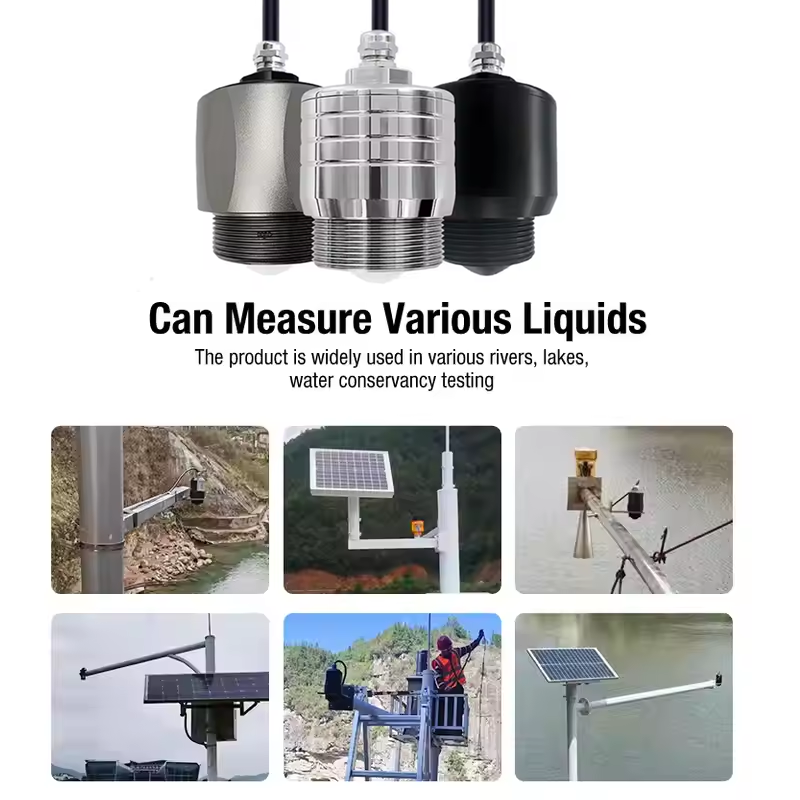
Contact Honde Technology for Hydrology Tenders
Honde Technology is a Germany TUV & Alibaba verified manufacturer. We supply the non-contact radar hardware, the solar power architecture, and the multi-country data-sharing protocols for the world’s most complex water systems.
For more sensor information and customized IoT solutions, please contact Honde Technology Co., LTD.
- WhatsApp: +86-15210548582
- Email: info@hondetech.com
- Company Website: www.hondetechco.com
Post time: Jul-29-2026